
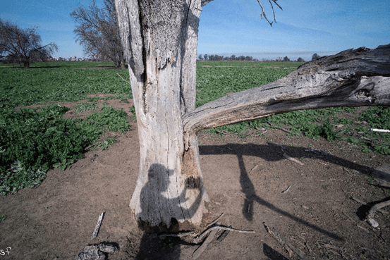
It was in 1776 when the Anza expedition skirted Mt Diablo along the Carquinez Straight, ending up in the marshland along the San Joaquin River. There, they came upon a dense grove of oaks in a four mile stand, a forest that would come to be known as Point of Timber. It’s hard to image such a forest now, there are only a few skeletons, backed up against Discovery Bay, a swill retirement community, seen in the distance. Once it was a forest full of wood sprites, water nymphs and legends. The legends of the tules, Anza knew of them, as did Fages, and Moraga. It’s how the Mountain got its name. Anza’s expedition then headed south, looking for a pass to Monterey through what is now Livermore, up the Tesla Grade, along Mocho Creek to Corral Hollow – the center of the southern part of the Diablo Range. Later, this trail becomes La Vereda del Monte, where droves of California horses were run from September through Spring, until the heat made it impossible. According to Latta, these droves began as early as 1800, well before Murrieta’s time, and as grueling as the trek must have been, were extremely profitable. A good horse was hard to raise in the cactus fields of Sonora and the
The images here are taken at the very end of Point of Timber Road; I’ve climbed the fence, past the no trespassing signs (of course) where the road ends in a bier/pit with about 20 bovines lying in the mud. The few decayed stumps that I find, in their prime, may have witnessed the round-up and branding of these magnificent horses. Point of Timber is referred to as The First Estacion, along La Vereda del Monte – Its more or less speculation, but this could have been the old rodeo grounds.
