This is a month ago, in the San Benito Mountains, and as you may recall, I’m ascending a series of inclines toward Condon Peak. The next rise is much steeper and I’m on my knees at the end, just to keep traction. At one point I start to slip and I’m hugging the earth. I stand and can see the southern part of the Diablo Range in the distance. This same range to the north extends to the hills close to where I grew up, and the oak tree has always had binding spell upon me. I am headed for the eastern edge of the San Benito Ridge, where Murrieta is known to have his hideout, where Harry Love pursued him in a running gun battle down to Cantua Creek, where he cut his head off and put it in a jar. You may remember, up Clear Creek Rd I reached a locked gate at Oak Flat, and so I had to turn around and find another way. I will continue my search later in the day, for now, Condon Peak is proving challenging enough. Murrieta would never attempt such an idiotic thing as to launch straight up the face of the canyon – there is another way and I will find it, but not this morning, this morning I am on La Vereda del Loco and where that ends is anyone’s guess
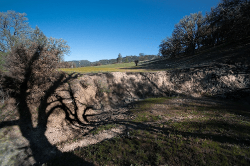
Looking down from a rise near Condon Peak trail, I have been walking nearly straight up hill for a mile, progressing up the mountain in steps, like stairs. I assume the trail is headed to Condon Peak., but there are no signs and I’m not following a map. I am breathing hard and I tell myself ‘the next rise, I’ll turn back’. Then the next one comes, and the next one. If you follow the crack, made from winter rains, you can get an idea of how long each of these steeps are. Looking south across the canyon where the San Benito River flows, is the tail end of the Diablo range, a pristine wilderness unchanged by time or human incursion – La Vereda del Monte
The slope looks like the back of a horse and I know I’m close, I can feel it. The rude rock just in front is referred to as serpentine barrens with unusually high concentrations of iron, chromium, nickel and cobalt, like weathered hands, that have shaped, and been shaped, it is a reminder of my place in the world. Just out of view is a locked gate and I can go no further without a combination. I meet a guy at Oak Flat campground and he tells me the combination is on my permit, I go back to my car and look, but see nothing resembling a combination. This is news to me, there was no mention of a gate, and no gate anywhere on the maps I reviewed. Obviously I have missed something crucial and I think of my own advice, posted a while back – Chance favors the prepared mind – and I am further humbled. I am on the trail, this is certain, but it is not taking me where I want to go. So it will take me where it wants me to go. I should make a decision soon, before it gets dark, where I am going to spend the night. Maybe here, maybe back at Condon Peak.
Looking down on Clear Creek, climbing to the ridge in the San Benito Mountains, I’m in a part of California that I have never been in. Murrieta followed this creek 175 years ago, changed only by the rain, the wind, and the patter of deer along the path that disappears into the manzanita. On a dirt road, I take it slow, not much faster than the dun colored horse he rode, broken in the corrals somewhere outside of Stockton, stolen and ridden hard through the San Antonio Pass and along the backbone of the Diablo Range, keeping herd on a hundred head wrangled from ranch lands near Livermore and San Jose. Joaquin made a living stealing horses, and gold dust, and it seems to me much of what he did was for the challenge of it as it was for anything. What struck me was the hard light and the color that put an edge on everything. Every rock, every tree, each rise in the land seems to have its own place as if it were determined to come into being just the way that it did, It is the will of nature I am witnessing, as if for the first time becoming itself, unique, without division, an individual consummate whole that breaks my brain in two, entering the point of awe when I open mouth and not a word comes out. As I make this climb, I pause, retrace my steps and repeat myself, for the journey is not a straight one, both image and story collide taking me in the direction that it does as if I too, were becoming for the first time and determined to bring myself into being. There are two stories I wish to tell: One is of these mountains as I travel, the other is of Joaquin Murrieta’s as he rode these same trails. Where the two will meet I do not know, but I do know that I’m following the Mountain Trail, La Vereda del Monte, for others have taken it long before me and given it a name.
Joaquin Murrieta was sixteen when the war ended and California was hijacked, along with Arizona and Texas, to became a state. He would have have heard his uncles tell the story of how it was stolen by the Yankees and lands that were lost or sold for pennies, but it was his grandfather who could remember the glory of Spanish rule and the royal road through the mythical land. California. He would have heard stories of grizzly bears, and the ranchos, and the wild horses that roamed the valleys, for he had a large family, all were vaqueros, and he had ridden in a saddle from the time he could walk. From what is known, he was well educated, so when the letter came from his older brother urging him to come and make his fortune mining for gold in the foothills of the sierras, he wrote in response. He was strong and young, and had a good horse, and with his sixteen year-old-newly-wed-wife by his side, his younger brother, and many in his family, he crossed the Sonoran desert to stake a claim on his future; he had no intention of stealing from anyone, he was off to make his mark in the world. By all accounts he was a man of composite presence, intense in bearing with blue eyes and a lineage from both Spanish and native blood, Marked with a congenial disposition he made friends easily, and was welcomed wherever he went. It wasn’t until later, when the trail he rode deep into the mountains reached the point of no return, and he had taken it too far and he knew it, that there was no turning back, and only the ridge in the distance and the pristine springs of the mountain path could save him and his hundred stolen horses. Out the window, along that creek, making the assent now, with the ridge in the distance – La Vereda del Monte.
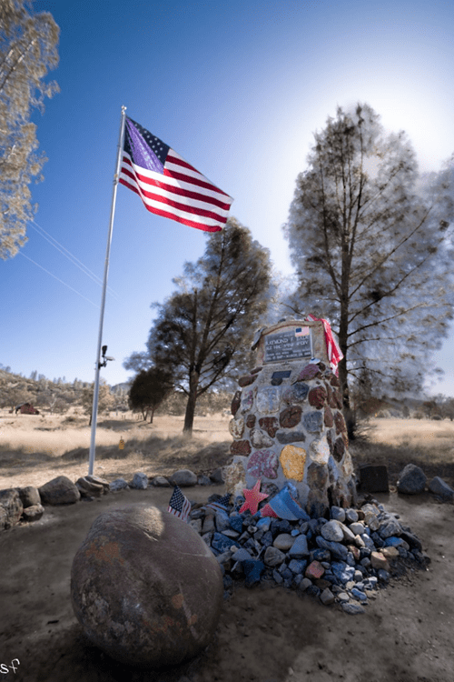
At the turnoff to Clear Creek is a memorial to a local, Raymond Eade who died in Vietnam with a Purple Heart. Beyond here we are on BLM land.
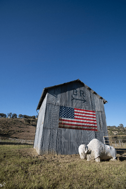
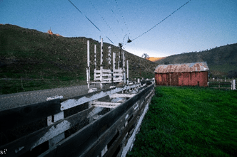
The franchise Buffalo Run owns just about every decent piece of land I pass, all of the ranches, all of the natural springs, and a flag is flying on most of them. Conservative and somewhat secretive, at least under the radar, I can find no reference to Buffalo Run Ranch other than in Utah. I’m combing through old news clippings now, I find reference to the roads to the Idria Mercury mines, the very ones I will be on when I enter BLM land and climb to Joaquin Ridge, built by inmates from the local state prison during WW1, used for the mining of Quicksilver inthe manufacture of percussion caps to make munitions, but so far the ranches, each called Buffalo Run, with a logo just like the one below, DO NOT show up on a Google search. And this has peaked my interest. If I take a trail that leads off the main route, I may surely find something, or get lost. Either way I’m looking for an adventure, trying to uncover something within myself. It has nothing to do with Joaquin and his band of thieves, and yet everything, I am drawn to these vaqueros of old California, for they strike some deep resonance within that comes from the land and the sky, and the desire to be free.
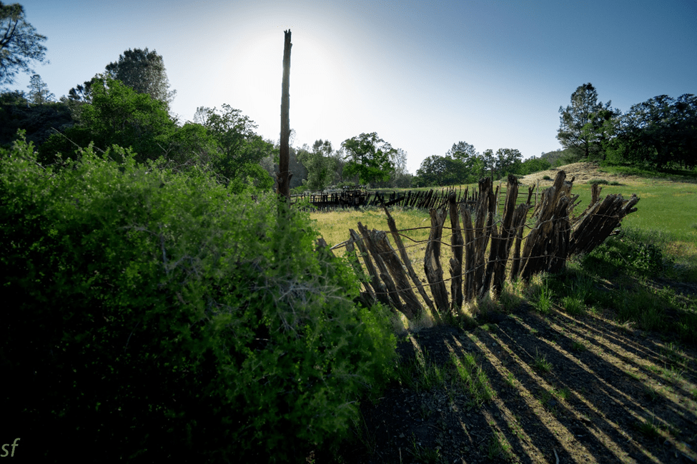
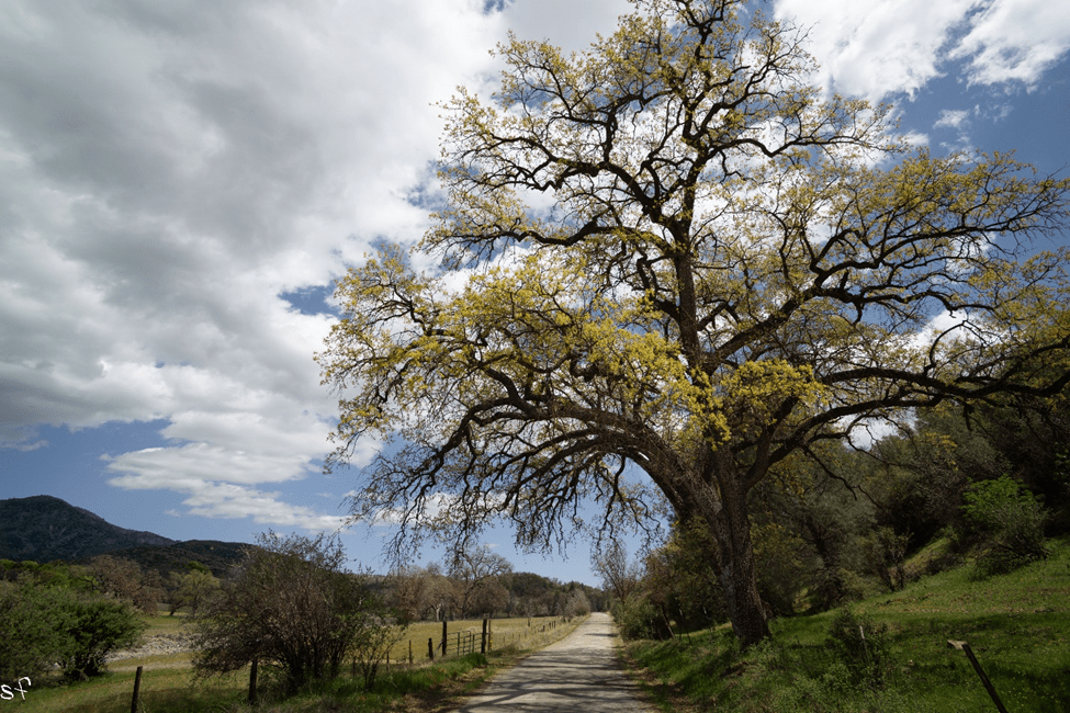
A fenced corral like this made of manzanita posts, rudely staked, but sturdy enough to contain a herd of wild mustangs, would have been very similar to Murrieta’s lair in the canyons above – La Vereda del Monte
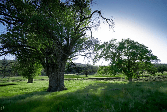
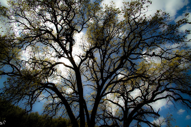
Joaquin’s Oaks – La Vereda del Monte – I was hesitant to jump the fence in this neck of the woods, everyone out here has a rifle. But two things motivate me, the light and the oaks. As I walk under the branches I am reminded of a poem about a mountain that holds you in its spell so completely that you forget everything you have ever been. The mountain, the trail, the tree remain, but nothing of your past.
Once you have had a thing and then lost it is it like you never had it or is the story that remains like a shadow of a dream you can’t quite remember
La Vereda del Monte – it is pure speculation how many times Murrieta made this trek, but one thing is known, he rode from Sonora Mexico at eighteen with his wife to a home in Niles Canyon, and before joining his half brother, Joaquin Carrillo, in Calavaras, to work the gold fields, he was a vaquero in Brentwood and worked the mustangs from the wild herds that roamed the central valley west of Stockton. He may have began herding horses at this time, legally, to Sonora Mexico, where he could turn a profit. If this is the case, he traveled the trail over a period of 3 or 4 years. To my knowledge it has never been ‘proved’ that he made the journey at all, what is known is that the trail, through Henry Coe Park, follows the Diablo Range into San Benito along creek beds like the one below. Meandering along San Benito River, I will shortly come to the turn off that takes me to the ridge, at least that is the way it looks on a map
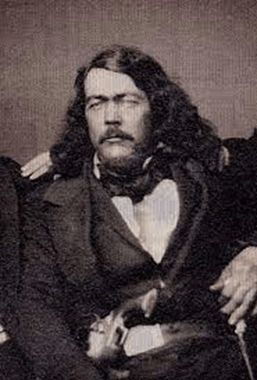
the common way a confession was obtained from a captured and accused Mexican, was to be hung from a tree, more than likely an oak tree, so that all blood ceased to flow to the head. And when the prisoner gasped his last before passing out he was released, enough to loosen his knot and be questioned. This is what happened several days prior to July 25, 1853 – Murrieta’s fated day- when Capt Harry Love obtained such an admission by similar means, from an unlucky member of Joaquin’s band, who gave up the hideout deep in the San Benito wilderness. Love, Captain of the California Rangers, an outfit formed by then Gov Bigler to apprehend the ‘five Joaquins,’, was a formidable lawman, and capable of any means to rid California of the scourge of Joaquin
La Vereda del Monte – I hadn’t seen a car in two hours either way and stopped in the middle of the road, jumped the fence and waited for the light. Listening to the creek roll over the rocks as if time had left no trace, it must have been much the same in Murrieta’s day. The ridge where I’m headed is in the distance and the turnoff only a few miles up, but it was slow going, for I could not pass through such beauty without giving pause
I was looking for the turnoff to Clear Creek which enters BLM land but kept getting distracted by what was out the car window. I had passed through to some other paradigm, you could sense it, the immense power of the earth in all its terrible beauty, in the oaks, in the clouds, in the way colors pierced your eyes. The turn off had to be around the next bend, I was sure of it. I wonder if I had known what it was I was in for if I would have continued, but I didn’t. so I did. I was on the Vereda del Monte, Murrieta’s trail, and there was no turning back.
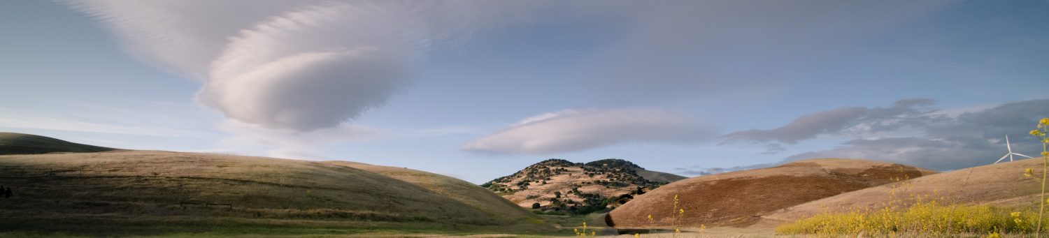
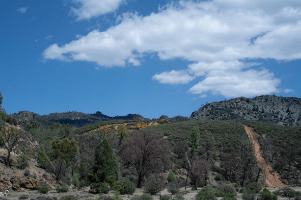
The highway follows Los Gatos Creek along La Vereda del Monte, the Mountian Trail and into Murrieta’s badlands. Once it crosses into San Benito County it’s full of ruts and potholes cutting through the southern part of the Diablo Range. With its highest peak at 5,200 ft, it ‘s nearly as inaccessible as it was 175 years ago when Murrieta herded his stolen horses past Spanish Lake through the canyons at Horse Thief Trail. Here we are at 1,500 ft; to the right we begin our ascent up to 4,500 and along the ridge
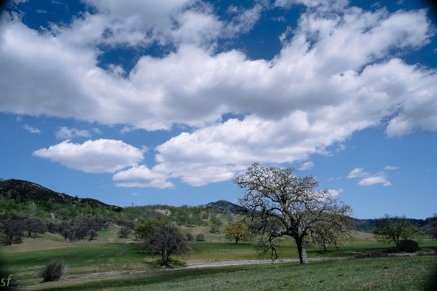
Blooming Oaks along Los Gatos Creek. Murrieta’s route, called La Vereda del Monte (The Mountain Trail), entered Coe Park at San Antonio Valley, where they rustled horses from Isabel Valley, holding them at Mustang Flat, then rounded Mustang Peak and headed south, past the Pinnacles and what is now Hollister There they would have followed the San Benito River up into the badlands. Much of the range crests over 4,000 ft in elevation and the peak at San Benito is 5,200. Joaquin Rocks, at the eastern edge of the range is where Murrieta had his hideout, complete with horse corrals. If you look at some of the maps I’ve posted, you can get an idea of how remote an area this is, even now. One thing that fascinates me about Murrieta is how well he must have known California.
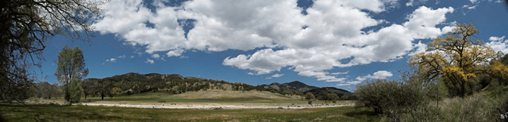
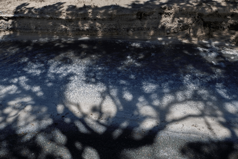
Joaquin’s Trail – Shadows along Los Gatos Creek – San Benito Mountain Wilderness, looking into BLM land
Outside of King City, the Coalinga Road is full of potholes, recently filled with asphalt. I pass a few ranches and rolling knolls and it’s slow going, but beautiful, and eventually I come to Oak Flat campground at the entrance to Clear Creek – an open wilderness managed by the BLM. It’s almost dark and a moonless night and the solar eclipse was two days ago and the sky is arid and alive with electricity. What I’m after is difficult to explain, other than to say I’m holding onto the tail of something that has influenced me to such an extent that I cannot let go. Out here, along the San Benito River, my own life is intermingled with history. I’m on the Mountain Path, la Vereda del Monte, which for me is everywhere and in all things, and as I pass through this land, it becomes my land, the same land as it has always been, the same as it was for Joaquin Murrieta. Murrieta needs no introduction here, other than to say, the fugitive horseman who drove herd from Marsh Creek, past Livermore, up the Tesla grade, through the San Antonio pass, and down the spine of this impassable range, still intrigues me. Every time I delve a little deeper, I find something about this misunderstood figure, every time I take it a little further, I find something about myself. The tale eclipses at Three Rocks, Murrieta’s notorious hideout, where, a century and half ago, his fortress of boulders outlined the mountain top, as it does today, as if flung there by giants. From there, he could look across the valley and see the last of the twelve Estaciones, where his crew of mesteñeros below, corralled the final drove of mustang to be herded to Sonora, Mexico.
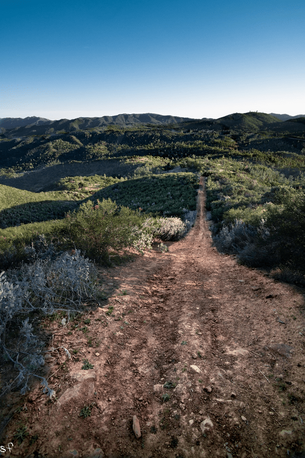
At Oak Flat, the night is populated with a blanket of stars, and without a moon, they are endless. It is with caution that I walk through the padlocked gate and follow the grade upward, the creek rushing below, the air invigorating, with no other sound, not even a coyote howl. In the darkness my eyes strain to see the road ahead, as it winds into the serpentine wilderness and vanishes into the night – to follow it in a car in the daytime you need a permit from the BLM, a code to unlock the gate, and a day to drive the forty miles. But it is the only way to the rocks, as far as I know. Tonight, I will take in the air, even tomorrow, without a permit, I will go no further. What I am after in the morning is reconnaissance; another way in that will lead directly to the rocks, even a trail that I can walk over private land. Finding it has been challenging, I have looked on every map I can get my hands on and googled to extinction, and other than Latta’s reference to the trail he took, eighty years ago, I can find nothing. From Cantua Creek, one can see Three Rocks distinctly, only a few miles from the highway*, but covering the terrain with its steep arroyos, even if I were to jump fences and cross private land, would be more than foolish. So my only hope to get to the rocks, other than to drive the road I am standing on, for six hours, then hike four miles more, is to get lucky. (*Highway 5 at Derrick Road),
The morning is bright with a cloudless sky and after a cuppa’, boiled on the stove, I make my way on foot up the canyon again. A couple of years ago I drove this road and not too far in there was a washout, and in the daylight, I want to see if the road has been maintained. I come to it soon enough, a Caterpillar Tractor standing on top of a mound of dirt. And although it doesn’t guarantee the road is in good shape further on, it’s a positive sign. If I can’t find another way in, I’ll reserve a permit when I get back and drive it. I’m going to Google the navigation lady for Joaquin Rocks Lookout Trail as soon as I can get a signal, for now, it’s still early, and I make my way back to Oak Flat and pack my gear.
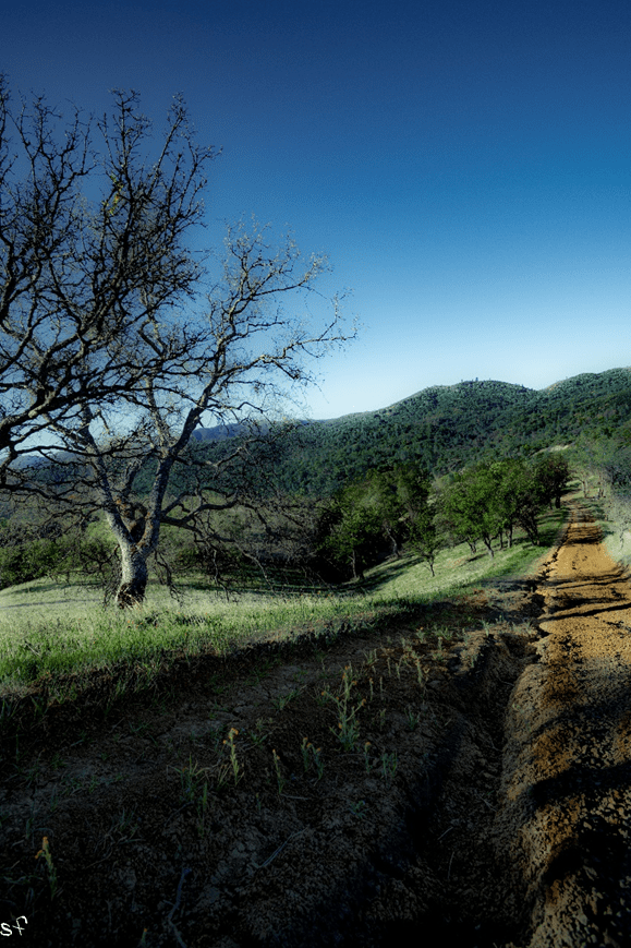
Coming to the highway, I cross the creek at the foot of the grade and pass the monument to Ray Eade. The flag is still flying, tattered and adrift in the breeze and I think of Vietnam as I pull onto Coalinga Road, and how I could have been him. Then I think of my father, a Marine, who served in Korea. I’m not holding back, I want to cry, but tears are hard to come by. Then the navigation lady on Google Maps is telling me that the ‘Lookout Trail’ is a few miles off and I head down the grade through the pass, stopping only once, when I drive into a glen, covered in shadow, and feel as if I’m being dragged into the earth by an old oak, basking in its glory. The hillsides are steeped in green, the water is flowing, with the windows rolled down, the croaking frogs bring a sound I have not heard in a long while, and with it, a swoon of memories. My earliest years were spent in a creek, a different tale all together, but it brings to mind how infrequent the sound of frogs is heard, and how there are fewer polliwogs than there used to be. In 500 meters, the google lady reminds me, is my destination, and as I prepare to pull off the road, I look in the rearview mirror, but nothing quite prepares me for this. It isn’t the gate I remembered at all, and the road in the distance, I am sure, I’d never laid eyes on.
An outcrop of rock with jagged peaks stands a couple of miles up the canyon, and the gate, with several padlocks, affronts private property, and at first glance, looks more like another road onto BLM land. I sit in the turnout and consider the predicament – this being my first fence jump since I was hit by a car on my bike a few months back – and I deliberate, how true is the path, and how real the obstacles? The decisive factor is the vaulted peaks, looming, just to my left.
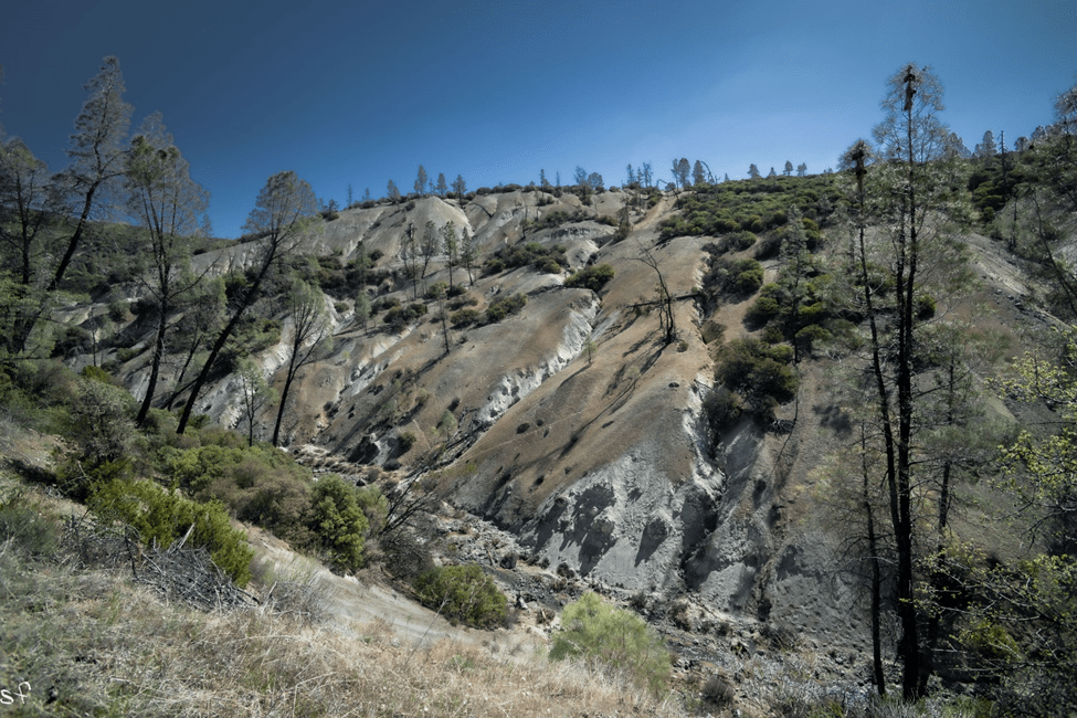
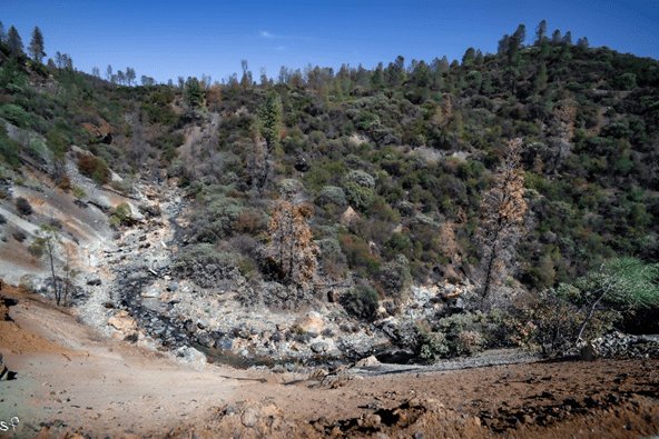
I always struggle with the idea of climbing a fence, and because I travel alone, make a small footprint, and take only pictures, I have no compunction, yet it is private land and comes with a risk. I hesitate, but only for a second, then I grab my bag and am up and over, then over the bluff in less than a minute. The creek on my left is rolling along at a clip and I’m stopped almost immediately where it cuts across the road., it’s only two feet deep but it’s twenty feet wide, with no visible place, up or down, to ford. I stand for a moment considering my next move; if I continue, my shoes will be soaked to the socks, not the best way to start off a hike, and then I’m starting to think, ‘maybe I should turn around, try and contact the owner.’ Then I look back over my shoulder in the distance, Like the Emerald City, a promontory that marks the gateway to where? I knew not, the odd color of the creek and the stark landscape had Murrieta all over it. ‘Even if it goes nowhere, there’s a picture in it’, I say to myself. So, with a new resolve, I take off my boots and walk across. After I put them on, a few hundred yards up, I see an outcrop of rocks, and the next thing you know, I’m on top of this boulder, as white as snow and the surface is sort of spongy like dried grass, only its white, like freeze dried snow, and I say to myself ‘WTF?’,
Then I dunk my head in the creek, which I later find out is called White Creek, and it snaps me around just enough to realize that this is magic, all around me, and just as I’m thinking to myself how fortunate I am to have taken this road, I see an ATM hugging the curve, down the hill like rain runoff, right for me. Instantly, I cast aside all future plans for adventure, at least for the day, and consider it’s either the rancher, or an employee, or maybe it was a ranger, barreling to the bottom of the grade, followed by a wisp of dust like a tail, in which case, I would have to talk my way out of a ticket. When next I look up, I can see it’s a woman in sunglasses and a windbreaker, maybe someone making the rounds, or it could be the law, they have women law enforcement in the BLM, either way, I was toast. When she pulled up, the first thing I said was, “I know I’m on private property and I apologize,” then I looked over, pointing to the spires etching the horizon and said, “To tell you the truth, I’m a bit of an adventurer, and I’m doing some research, looking for a trail that goes up to Joaquin Rocks, it’s called Las Tres Piedras.” I recited with a slight accent, “Have you heard of them?” At which point, you cracked a grin and said, “if you’re thinking about getting to the rocks this way, you’re out of your mind,” then looked me over, more like a curiosity, as if I would dare such a feat, starting out at noon, with a water bottle, and what, a camera? Yes, I was a photographer, I told her, but today the light wasn’t very good, and you said, “What, you don’t like the sunshine?” And I said, “ too much contrast.” and you said that you liked the cloudy days too, same as me, and I said, “I’m going to come back on a better day” and then you asked me if I wanted a ride down to the gate, informal enough, so I said that I would prefer to walk, “Do you mind?” Making sure to say it in a way like I was asking for permission, which I was. “Naw, I don’t mind,” you said, then you asked, “What do you want to go to the rocks for, anyway?” and before I could answer, you said, “You know the best way to do it is to contact the BLM, get a permit, you can drive all the way back in there, right along the ridge, until you come to the end of the road, and a turnout, where you can camp. From there, it’s only a three or four mile hike in.” I listened attentively, in part because I like the story, in part because I was wondering just who I was talking to. So I asked her straight up and she said that she was the daughter of the rancher who started the ranch up here, nodding up the hill, and then I asked her if she was born here, and you said ‘yep’ and then I asked if you lived here your whole life, and you nodded, and I said “went off to university, right?” and you said, “oh yeah,” with a wryness, “you live on a ranch, you have to pretty much help support it, I taught high school for god knows how long.” Frank Latta taught high school, and then I asked her, out of the blue, if she ever heard of him. And even through her sunglasses, I could see her eyes widen and the next thing I know, she’s telling me that the photograph in Frank Latta’s book, of him riding horseback with his family to Joaquin’s Rocks, in 1935 – the very book I’ve been studying for three years, the very trail I am trying to find – is her grandfather standing next to her grandmother – who owned the land I am now trespassing on. Mr. and Mrs. Birdwell of Los Gatos Canyon gave Latta permission to ride the trail, and picnic at Joaquin’s favorite camping spot where, according to Latta, hand gestures were exchanged from Ojo de Aguila (Eagle Eye, aka: Juan Lopez), perched on the promontory, and using a spy glass to see onto the valley floor at Cantua Creek, where the twelfth and final Estacione was located before the herd was driven directly south. (After Murrieta and his crew had gathered the desired 300 head, this next leg, all the way to Sonora, was run by a different crew chief, Teodoro Valenzuela.)
At this point in our conversation, I asked if the offer for a ride was still on, and you said “of course” and I climbed in, expressing my gratitude and said, “It will keep me from having to take off my shoes at the creek,” and you laughed. Then I asked, how come the creek was so white, and you said, “magnesium,” and then you told me that you used to drink it all the time as kids, every time you went swimming in the summer. “Tastes a little funny, but it doesn’t hurt you, keeps your teeth white,” you said with a smile. On the rest of the way down you told me about Latta, and a friend of yours who just wrote a book on Murrieta and was busy writing another one on Loco Marianna, who claimed to be Murrieta’s mistress. And then I told her a little about my project, and we swapped emails, and when we came to the gate, I dipped through, the way I came, looking back with a wave. Pulling onto Los Gatos Creek, I tried to process the tail of the eclipse that I was holding onto – way outside the path of totality, I concluded, there is another path. Joaquin Murrieta gave it a name.
Cattle chute off Del Puerto Canyon Rd. At round-up, cattle are herded through and penned upright for branding and other inspection. I’m not sure what’s going on here, maybe an auction. In Murrieta’s day, juniper posts were used at the stations along La Vereda and Las Tres Piedras was the branding iron. The road follows the old droving trail, crossing Hideout Canyon, where mustangs were corralled, sometimes stolen from ranches along the Sn Joaquin Valley. or running wild in the marsh lands of Lake Tulare. Del Puerto Canyon, following Colorado Creek, is about as remote as California gets. It’s all private property now, with no access. I had the good fortune of meeting a cowboy on this trek, who was feeding his horses off Mines Rd when I passed by (previous post). He offered to take me out in his side-by, ‘take you anywhere you want to go,’ he told me on the phone, ‘I own all that land.’ What? trying to contain my enthusiasm – he also owns these magnificent California mustangs, full of vinegar, when we meet, the next time I’m out, I’m going to ask him if we can saddle-up and ride,