Feb 20, 22 – John Luiz

La Vereda del Monte

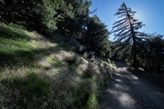
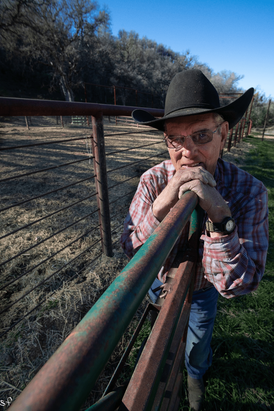
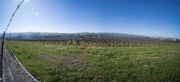
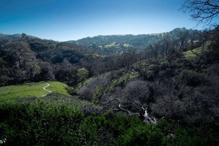
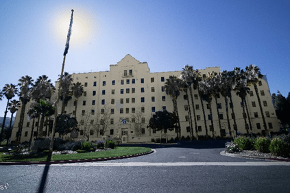
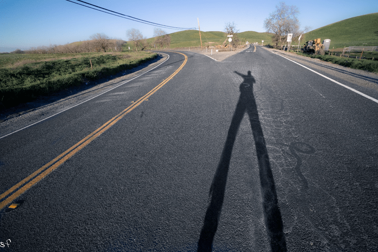
up the grade, keeping my eyes peeled for Coyote Creek, or a valley to the west, Blackbird Valley it says on Google, it used to called Valle de Mocho and it’s where the 4th Estacion on la Vereda was located a hundred and seventy-five years ago. Mocho was crew chief, gathering herd and corralling all winter, branding them with the Tres Piedras iron and waiting for Murrieta’s next drove with his eyes on the horizon, around the seventeenth of each month, looking for smoke signals from off the top of Brushy peak. And I look over my shoulder and see this old cowboy and four horses, feeding off a bail of hay, and I keep driving a ways up, looking for a place to turn around. Maybe he would let me take a shot of his horses, or maybe he could tell me where Coyote Creek was, I didn’t know exactly why but I knew I had to turn around, instinct is what it was, as I was to find out. So I pull a Uee, and drive back and when I get there he’s still in the pen, and I holler over, if he’d mind if I asked him a question. He sat in his truck, with the four horses gnawing on the bail behind him, and looked over, sort of dead pan and said. “No, not at all.” like he didn’t have a thing in the world better to do. And I ask him if he’s ever heard of Coyote Creek, and he says, ‘Sure, about three miles, straight up the road’ and he points. “How’d you know about Coyote Creek?” he asks. And I say, “I’ll tell you about it in a minute, but first, I have another question.” And he looks at me, slightly amused, although it’s hard to read this old timer, he seems genuine enough, “not at all,” he says. So I ask him if I can photograph his horses, and I walk over and this Sorrel’s friendly and feisty, comes sniffing over, and i get a shot or two, I don’t want to take too much of this guys time, so I walk back and ask him if he’s ever heard of Joaquin Murrieta, and of course he had, and then I tell him about Mocho,, and his eyes get a little wider, although it’ hard to tell behind his tinted glasses, and he says “You know this is Mocho Creek, right here” And then he tells me how to find Coyote Creek, that his friend owned the land that goes back up in there, explaining that I go up the grade, then it drops, and just before it starts up again, toward San Antonio Valley, “there’s a gate on the left, with three wagon wheels.”” A gate?” I ask him, and he nods
“Bout three miles,” he says again. “give or take,”
Then I ask him what his name is and he says: John Luiz, it’s a Portuguese name,” even though he speaks like he’s from Texas. I get his phone # and as I’m driving away, he says: “Be careful. I just heard there was a motorcycle accident, just past there.” Through the window, I ask him if those are California horses and he smiles real big, and I tell him I’m going to call him. I didn’t want to go so quick, but the light was dropping, and I wasn’t even there yet

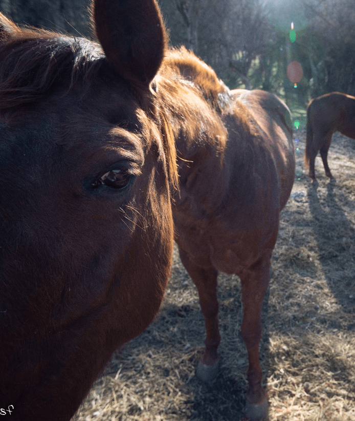
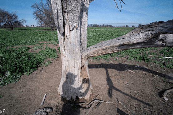
The California Sorrel is known for its stamina, it needed it to make the 800 mile trek to Sonora, This one, bred in these mountains, is very much the same horse as were common in Murrieta’s droves, it has no fear and walks straight up to the camera.

Feb 18, 22 – Mines Rd

La Vereda del Monte

Following the Mocho River up Mines Rd, south of Livermore. I’m approaching Estacion #4 – at Coyote Creek, behind me is Mt Diablo, still visible through much of the pass. During one of Murrieta’s Droves, he would have had almost a hundred and fifty head by now, driving them to the next Estacion. I’m not sure about the #’s, of the stations, this may be Latta’s ‘contribution’, but certainly these little ranchita’s in the mountains were referred to as Estaciones. Latta marks 11 of them, the 11th, at Cantua Creek, 150 miles south from where we are. Over the entire trail, la Vereda del Monte, herd stock was gathered, until it reached 300. Latta is adamant on this, interviewing several sources, indicating that these droves were organized to the nines and run professionally, with a schedule, a quota, and an organized crew. Mocho was crew chief of the station at Coyote Creek. Often living through the winter, with at most a couple of his vaqueros, he roamed these majestic mountains, gathering, trading and corralling the California breeds, still running wild in the Diablo Range.

further along Mines Road, scruffy oaks, sage and manzanita, the unique California habitat relatively unchanged since the days of Murrieta’s horse droves. We’re on our way to Coyote Creek, in the Diablo Range, where Mocho was crew chief at the 4th station along the trail

Feb 17, 22 – Livermore

La Vereda del Monte

I’m in front of the In and Out hamburguesa joint on Livermore Bl – headed for the hills. I’ll bet Murrieta had a few in his day, not from In and Out of course, but where we’re headed, Estacion #3, Arroyo Mocho, where the Veterans building is now, on more than a few occasions, during one of his runs herding horses to Sonora, he must have had a burger or two. When they arrived, he’d make make sure they had water, then join the herd with the horses Mocho had gathered At each station along La Vereda, the herd would grow at #3 the herd would be maybe a hundred fifty. Some he’d hobble, others he might run through a chute. That must have been an unpleasant task, some of the best horses had to be cut and hung, then butchered, if not, it would have to be done on the trail. The stronger the horse, the more aggressive, and one stallion could disrupt an entire run. Both thinning and fattening happened at each station, from here to Cantua Creek, and we have a long way to go to get to Cantua. Now, I’m getting ready for Mocho – the Cutoff One – coming up. But before I do, I’m taking a pitstop to consult my notes and the oracles in the parking lot. I have a bindy of yogurt and blueberries from the cooler, the guy in his truck beside me is gnawing on some kind of Double Double wad and looks over, kinda, without really looking over. We live in a strange world.

While Murrieta was on a drove, Jesus Feliz carried letters and supplies from his sister at the Niles Canyon ranch to the stations along La Vereda . When Murrieta was gone, Jesus tended to his sister, Latta: “He looked after the welfare and safety of his sister who had been assaulted by the mob near New Diggins.” A part of this tale we have yet to broach, but consider, Niles Canyon is only a few miles SW, and it is easy to imagine the youngest of the Feliz brothers, who was too young to participate in the droves, but played his role in the family business. He plays a role later on as well, following the murder of Colonel Bean, following Captain Harry Love and the California Rangers, but I’m getting ahead of myself, first we must get to Estacion #3. and a river named after Mocho, the cuttoff one

Feb 17, 22 Arroyo Mocho Estacion#3

La Vereda del Monte

In a photo of Mocho sitting on a horse, his pant legs, looking a lot like Levies, are rolled up a good 6 inches in a cuff. He was part Chinese and short. Hence the name Mocho. Latta interviewed him and he said that by smoke signals he knew within 2 hrs when to expect a drove. This is Arroyo Mocho, Estacion #3 looking South East, Behind me is the Veteran’s building, it is about as glorious a land as there is on this earth, and I breath it in.

The Veterans Administration building, built in 1929, the site where Latta claims the 3rd Estacion was located

Feb 16, 22 StoneHouse

La Vereda del Monte

La Vereda – I jumped the first fence and nearly rolled down the hill, I’m in bliss, the grass is knee high and the smell brings me back to my romps through fields as a boy, and as I come over the next little rise, I look down upon his ranch, and there it is, the Stone House. I can clearly make them out now, the stones, with the wood cut over the windows. Marsh was an important figure in Contra Costa history, not much room for him here, other than to say he was involved in the horse trade, was white, and was murdered a few years after Feliz’s raid, on the Pacheco Rd, not by bandits, but for vengeance. That story, another time, this story involves Claudio Feliz, and if you believe Mero’s account, Feliz portrayed himself as an Argentinian horse trader, had lunch at Marsh’s ranch, then returned later in the night, couldn’t find the cash box, stole horses and butchered one of the guests, presumably the gentlemen doing business with him earlier. Maybe so, but maybe not quite so. I’ve read little other than these accounts, based on news clippings, which are not entirely reliable, and even Lorrie Wilson in her book The Joaquin Band: History behind the Legend, takes more or less the same view. My take is there is more to it than bandits and butchers. Feliz mined gold and was a vaquero, like all these guys, and came from a family of some prominence, how else could he portray himself as an Argentine horse trader? As you recall, he is the older brother of Rosa Feliz, Murrieta’s wife. All of them were born in a town that bears the Murrieta name, in Sonora, of Spanish decent, and all of them, it seems to me, were ‘honorable men’, at least in their own dealings, Murrieta, Feliz, Valenzuela, they all spoke English, not that that should matter, but fluently, not all Californios could do business as Murrieta’s gang could. The Argentine swindle, maybe, but random terror in the night, they had to be motivated by something other than loot. Besides, with a name like Claudio Feliz – happy clouds, doesn’t exactly conjure images of terror. Quien sabe? But it does raises this whole political question: racism, the Californio, and who owned the land in 1850? ‘Dr’ Marsh sure had his fair chunk, he made his contribution to early California culture, to be sure, but as far as the horse runs go, he was a horse trader, and both aided and made money off Murrieta and his droves of Mustangs going south.- La Vereda del Monte

Feb 16, 22 – El Camino Diablo

La Vereda del Monte

La Vereda – The ghosts of Joaquin’s vaqueros, watching the trail from the ridge along Camino del Diablo. Starting in September, on the 15th of each month, the horse runs left Point of Timber, and Marsh’s ranch a day or two later. If they had a hundred head they would be fat. At each Estacion, approximately every thirty miles, they’d pick up more herd. These were Joaquin’s vaqueros, his ‘gang’, many, from birth, who knew the trade, the trails and the profits from running horses. But most of all, one must consider that they loved what they did. They loved horses, and the moonlight and the fireflies, and dancing with the senoritas. We’re headed for Mocho Valley, south of Livermore, where La Vereda crosses the San Antonio Valley. Mocho, the cuttoff one, was crew chief of two prominent Stations at this northern leg of the trail. I’ll post a map soon enough to mark them, but for now, the light is fading and I’ll be lucky to make it over Vasco Road before sundown.

One of the more amazing modern experiences, like riding through a sound tunnel over Vasco Road, its eighty five miles per hour of non-stop woosh, even on a Saturday, cars flying by, no place to pull over, giant windmills on the slopes. I vow to return at a future date, but I make it as far as the city limits, passing the Vasco Caves, outcrops just to the west, a known outlaw hangout, and Brushy Peak, to the east, both landmark on the trail. From Brushy Peak you can see for miles, and smoke signals were used to let the Stations further up the pass know when the drove had made it that far. I’m not going to climb that peak on this trip, but I do some recon, and would love to return to photograph the windmills, they are surreal. I pull into the Vasco Watershed reserve and the gate is closed for the night. A few minutes later a Sheriff pulls up and waits. He looks like he wants to go home. I’m ready to call it in as well. We’ll pick up the trail in the morning, following Mocho Creek. up Mines Rd, and to the next Estacion on the trail – La Vereda del Monte.

Point of Timber

La Vereda del Monte

It was in 1776 when the Anza expedition skirted Mt Diablo along the Carquinez Straight, ending up in the marshland along the San Joaquin River. There, they came upon a dense grove of oaks in a four mile stand, a forest that would come to be known as Point of Timber. It’s hard to image such a forest now, there are only a few skeletons, backed up against Discovery Bay, a swill retirement community, seen in the distance. Once it was a forest full of wood sprites, water nymphs and legends. The legends of the tules, Anza knew of them, as did Fages, and Moraga. It’s how the Mountain got its name. Anza’s expedition then headed south, looking for a pass to Monterey through what is now Livermore, up the Tesla Grade, along Mocho Creek to Corral Hollow – the center of the southern part of the Diablo Range. Later, this trail becomes La Vereda del Monte, where droves of California horses were run from September through Spring, until the heat made it impossible. According to Latta, these droves began as early as 1800, well before Murrieta’s time, and as grueling as the trek must have been, were extremely profitable. A good horse was hard to raise in the cactus fields of Sonora and theA dirt road with trees and grass

Description automatically generated California horse was so plentiful that they were being eradicated to keep them from eating the grazing needed for other livestock (sheep and cattle). In 1810 over 3,000 mustang were driven over the bluffs in Monterey alone. (Murrieta and his Horse Gangs, Frank Latta)

The images here are taken at the very end of Point of Timber Road; I’ve climbed the fence, past the no trespassing signs (of course) where the road ends in a bier/pit with about 20 bovines lying in the mud. The few decayed stumps that I find, in their prime, may have witnessed the round-up and branding of these magnificent horses. Point of Timber is referred to as The First Estacion, along La Vereda del Monte – Its more or less speculation, but this could have been the old rodeo grounds.

Tres Pinos

La Vereda del Monte

Many things in this story recognize the significance in the number three. Leaving aside its relevance to popular culture, numerology, the church, or even alchemy, Murrieta and his gang of vaqueros had a specific attraction to the #. Latta, in his book, Joaquin Murrieta and his Horse Gangs, talks at length about it. The brand they used, Las Tres Piedras, for example, and how, as a means of a simple handshake, or a signal to discretely telegraph an ally, in a crowded bar, or three fingers on the brow of your hat, for example, or if there was a message to be given, or some urgency in the form of a warning, a cowboy might place his thumb in his belt and dangle three fingers over his pocket. Place names reference the number 3, and as I’m driving through the pass, just north of the Angeles Forrest, off the138, looking out at the San Emigdio Mountains, I pass a little town called Neenach, that has a little school with the same name, and just past that is a sign that says, Three Points, and I wonder. We’re passing through the land of the Tejon, which means badger, a name given two hundred years ago by the white man to some of the earliest tribes of California. For thousands of years the Kitanemuk roved in bands, all the way to the Tehachapi mountains. About twenty miles to the west is Fort Tejon – indicative of what they did about the Indian troubles – but what intrigues me more than that is the name, Three Points – and the fact that you can drive along dirt roads out here for a half a century and still be driving on a dirt road. I’m not exactly sure what I’m looking for, it’s a familiar tune, and a familiar feeling, sort of like being lost, but never too far away from finding something. I’m not wandering as much as I’m following, searching, maybe, as much for a ‘feeling’ as for an answer. The Tejon were a fierce breed, and when Murrieta made the mistake of stealing their horses they tracked him down, along with his gang, and forced them to surrender, not just the horses, but everything they owned, right down to the buttons on their trousers. This account, printed in the Alta California, during the General Bean assassination trial in 1852, according to Reyes Feliz, Murrieta’s brother-in- law, who was interrogated, then gave a deposition, that he was let go in the brambles butt naked. After the trial he was hung, not for Bean, but for confessing to another crime, such was his miserable fate. I’ll save that one for another time, the assignation of Bean is chalk full of California intrigue right out of Zorro and I don’t want to deviate from the chief, who stripped them and set them afoot in the brambles, where Reyes was then mauled by a Grizzly bear and left for dead, somehow managing to crawl halfway back to the mission at San Gabriel, where he was remanded, only to be hung, such was his fate My curiosity at this impasse, just outside of the town called Neenach, isn’t General Bean, or even the name of this place – although it is an unusual one, and I would hope to remember it, if ever I should put use to it in the future – is up the incline following this fertile crescent that makes its way into the forest, and how far is the town of Three Points? Or, is it even a town? The light on the hillside is much as it was the day Murrieta rode on the firm back of Mozo to see his lover Anna Benitiz the week before General Bean was murdered, in 1852, and when he returned from San Gabriel, what trails did he ride on, on his way to the Monte tables along Tulare Lake?

Cantua – Dec 31, 23

La Vereda del Monte

There are varying accounts of Murrieta’s death and I will be referencing it often, as it plays a decisive role in our interpretation of the outlaw fugitive as an archetype residing with an honorable visage, or a scoundrel. resorting to homicide as a way to survive. One account, repeated in lore from the beginning, is the famous leap from the sidewalls of Cantua Creek, into the creek bed, followed by a fuselage of cap n’ ball fired from the banks until the unfortunate soul, presumably Murrieta, whose horse was shot from underneath him, presumably el Tigre, fell to his knees, sinking in the sandy wash, and holding up his hands, exclaiming, “enough, I am dead,” or some such rot. The sides of the creek are pretty much as Rollin Ridge describes them in the original account, and it echoes the account given by Captain Howard (one of the Rangers who participated in the ambush at Cantua) – it still is today, in places, a 10-12 drop, straight off, making a dramatic story, but pushing the credibility of any horse, no matter how talented, even el Tigre. There are accounts of stories, documented by Latta, of grandfathers who were there; el Tigre was one of two horses, whose names are noted and referenced as exceptional animals owned at one time by El Famoso, as Latta refers to him, so it is likely that el Tigre was the horse cut in half by the 36 Cal Colts, blowing chunks off, or at least through an artery. But that’s where the veracity of the story crumbles. The vaquero in the creek with his hands up, whose head was cut-off and stuck in a jar, was Murrieta’s hostler, a horse guy from Monterey, which means he grew up with horses, and was at that moment, tending el Tigre’s sore back from the strenuous hours of eluding, or attempting to elude, the relentless pursuit of Harry Love and his Rangers, when just then, Love and Co, appeared with the sun at their backs, coming over the ridge, like Gandalf and his clan, or other such phrases of the fable.

Higuera and Herrero were Californios as well, born in Monterey or Santa Barbara, which is to say one of only two generations that could claim that title, and again, are described, by descendants, in stories documented by Latta, that they witnessed the ambush, and after, describe knocking the walls down upon the dead, and then later, returning to rebury them in unmarked graves. Leading to the formidable quest, where is the grave of Tres Dedos? Both Hig and Herr worked under Pedro Gonzales, the youngest crew chief, and most accomplished rider of the gang, which is to say, among the best in the world, more about him in the pick-up a silver dollar off the trail, post, coming up.

La Vereda Viejo – Dec 30, 23

La Vereda del Monte

The main concern with the migration of any livestock, whether it was rustled from the San Joaquin plain, or rounded up in the marshlands that followed the river as it snaked down the middle of California, was water. Following gravity from the highest point, the Sierra mountains, to the lowest, which at that time was Tulare Lake, a body of water so enormous they used steamboats to ferry livestock on their way to the butcher shops in San Francisco where they had refrigerated cars that could transport sides of beef to Chicago, or Memphis. or Louisiana – The lake doesn’t exist anymore – funny how that is – making it difficult to imagine what it might have been like. You couldn’t see across it, it wasn’t deep, compared to great lakes, but its surface was bigger than Lake Tahoe; only different, it was marshland, where the Tule grass grew higher than a man and so thick you needed a machete – the long bladed knife that vaqueros carried as part of their gear – to clear the paths to where the feral mustang were rutting, and sometimes a Grizzly would forage through, hoping for an old mare too weak to keep up with the herd. Murrieta knew this craft from his early days in California, in Brentwood, where he was a mesteñero, at the rodeo grounds on Dr. Marsh’s land. And he also knew the value of water, not always accessible in California, the terrain, and where the springs were. He would pay attention to the water, his livelihood and that of his crew depended upon it. The Old Trail, more or less follows Highway 5 and skirts the Diablo Range to the west, La Vereda Viejo, Anza’a trail, passes places like Los Banos, and the San Luis Reservoir. Springs like this one, are marked by groves of sycamore, cottonwood, or eucalyptus. These were gathering places for herds migrating, domestic animals, cows and goats, sheep and horses, some not so domestic like the mustang. A pond like this at midnight in the middle of a hot summer would be teeming, eyes aglow, coyote’s yapping, a place to hunt if all you had was a bow, a place to roost in, keep an eye on, have your spies out, if you were looking for a stolen a herd coming through the canyons, up the Panoche Pass, or El Camino Diablo, to Horse Thief Canyon to Mustang Peak, where many tributaries, intersect with Murrieta’s trail – La Vereda del Monte.